## Overview Written by William Farrand, Senior Research Scientist, Space Science Institute Earth planning date: Friday, June 12, 2026
Instead of moving from stage to stage at a music festival, NASA’s Curiosity rover has been climbing Mount Sharp, traversing distinct geological "bands" of exposed rock that differ in texture and tone.
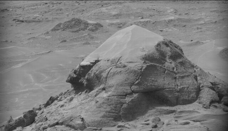
## Sols 4920‑4921: Rough‑Textured Dark‑Toned Bedrock During sols 4920 and 4921 the rover was positioned within a unit characterized by a rougher texture and dark‑toned bedrock. Because the surface was too coarse for brushing, the team performed APXS chemistry and MAHLI micro‑imaging on the untouched bedrock targets named “Salto La Cascada” and “Puerto de Rosas.”
ChemCam was directed to conduct LIBS spectroscopy on a bedrock target called “Kishuara” and on a small, layered float rock named “La Rosita.” The instrument’s Remote Micro‑Imager (RMI) captured views of the “Mishe Mokwa” butte and also imaged dunes that displayed tonal variations.
Mastcam mosaics were assembled of the “Valle Grande” channel, the “Kimsa Chata” butte, nearby troughs, and the aircraft‑carrier‑shaped rock “El Matir.”
## Sol 4922: Approaching the Upper Edge of the Dark Band A subsequent drive brought Curiosity nearer to the upper border of the dark‑toned band. Brushing remained impractical, so the team again used APXS and MAHLI on dark‑toned bedrock targets “Santa Gracia” and “Laguna San Rafael.” ChemCam LIBS also sampled this bedrock.
Mastcam mosaics captured a layered rock and adjacent troughs, as well as a mosaic of the smaller butte “Miraflores,” which shows a striking layered structure with ragged dark rocks on one side and a dust stack atop the other. Additional activities included a long‑distance RMI mosaic of a bright unit on “Mishe Mokwa” and Navcam dust‑devil surveys throughout the sol.
## Communication Challenge on Sol 4923 Although Earth‑Mars communications have become routine, they can still be problematic. On Friday, the team did not receive a timely downlink of data for the drive planned for Sol 4923. Without those images, planning subsequent drives, in‑situ examinations, or targeted remote‑sensing observations was impossible.
## Sols 4924‑4926: Planned Activities The three‑sol plan (4924 to 4926) includes: - A 360‑degree Mastcam mosaic - Automatic AEGIS targeting of LIBS measurements on each sol - Navcam dust‑devil surveys - APXS atmospheric measurements - Additional environmental monitoring activities
## Looking Ahead On Monday, the delayed downlink will be used to design the first investigation of the next geological band—a smooth‑textured, light‑toned surface unit—and to execute another drive that continues the systematic surveying of the bands.


![[Pending Translation] كأس العالم 2026: الولايات المتحدة تضمن حضورها في الدور الثاني بعد فوزها على أستراليا 2-صفر](https://s.france24.com/media/display/e98fad16-66c8-11f1-96db-005056bfb2b6/w:1024/p:16x9/2026-06-13T013936Z-709115587-UP1EM6D04LZCZ-RTRMADP-3-SOCCER-WORLDCUP-USA-PRY.jpg)